


Before Wavell Heights became a densely settled northern Brisbane suburb, private buses helped connect a district still changing from farms and scattered homes into the postwar neighbourhood residents know today.
Known as West Nundah until 1941, the area was still largely semi-rural during the first half of the 20th century. Dairy farms, pineapple growing and nurseries remained part of the landscape, while residential development was comparatively sparse. Brisbane City Council heritage records show Hillcrest Avenue had only three houses in 1939, with farmland occupying much of its surrounds.
The transformation accelerated after the suburb was renamed Wavell Heights in 1941 and marked for substantial postwar development. Housing spread across former farm holdings, new schools and churches followed, and transport services expanded with the growing population.

Before the houses filled the hills
West Nundah had begun to subdivide well before World War II, but development remained uneven. Heritage records for the former Westwood Farmhouse describe the surrounding district in the early 20th century as an area of small dairy and pineapple farms, with estates gradually creating streets including Zeehan, Deloraine, Barker and Palomar.
Another surviving residence in O’Donnell Street reflects the same semi-rural period. The property became home to a nursery that suited a district still dominated by dairying and pineapple growing into the mid-20th century. Residential estates were appearing, but much of the future Wavell Heights had not yet taken on its later suburban character.
Plans for much larger change emerged during World War II. Council heritage research records proposals in 1941 to develop West Nundah as a postwar residential suburb, with Queensland Housing Commission homes planned along new streets. The district was renamed Wavell Heights that year, after British military commander Archibald Wavell.
A patriotic concert at Nundah’s Imperial Theatre on 9 October 1941 marked the new suburb name.
Housing arrives on former farmland
The end of the war brought the development that had been anticipated.
In October 1946, the Queensland Housing Commission acquired more than nine acres of the Pfingst family farm for low-cost housing. The original farmhouse on that portion of the property was demolished as new streets and homes replaced much of the agricultural land.

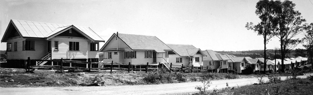
Hillcrest Avenue showed how quickly the change occurred. Council heritage research records only a handful of houses there in 1946, but by 1950 homes occupied almost every subdivision on the southern side of the street. Schools, churches and transport services were added as the population increased.
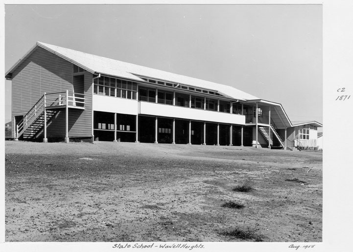
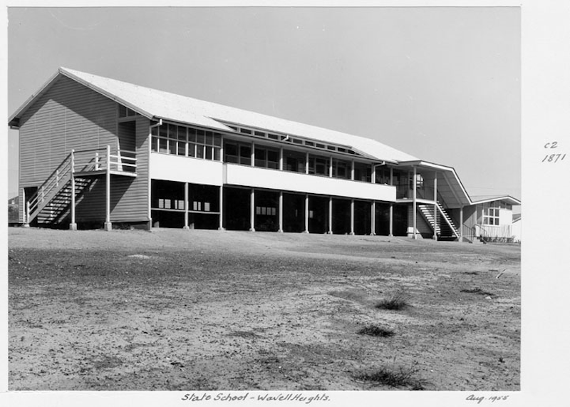
Wavell Heights State School became another marker of the suburb’s growth. The local progress association had sought a school as early as 1942, and the school eventually opened on 27 January 1948 with 113 students.
The former West Nundah Methodist Church was also extended in 1947 to accommodate a growing congregation after large estates in the area were subdivided.
Private buses filled the transport gap
As housing spread across Wavell Heights, residents still lived beyond Brisbane’s main tram network.


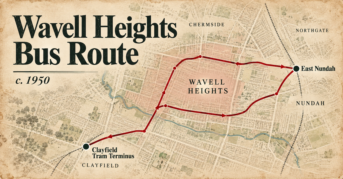
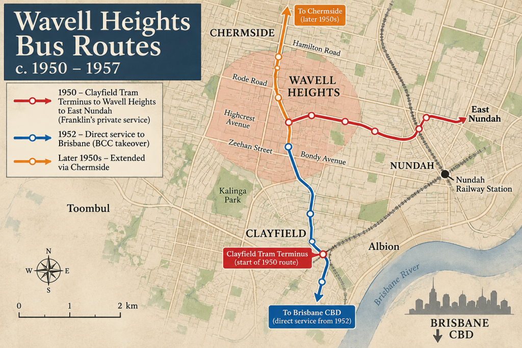
By February 1950, a privately operated feeder bus linked Wavell Heights and East Nundah with the Clayfield tram terminus. The route allowed passengers to reach Clayfield and transfer to Brisbane’s tram network for onward travel towards the city.
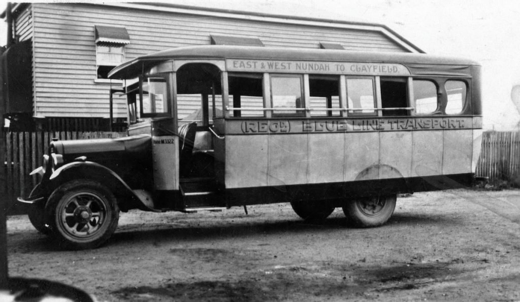
The service was operated by Ivan Godfred Franklin after he bought the Clayfield–East Nundah–Wavell Heights passenger licence in September 1949. Three buses were included in the sale, including a 1934 International that was photographed on Rode Road in Wavell Heights in May 1950.
The surviving photograph is a particularly clear record of public transport in the suburb during its postwar building boom: a private bus travelling through Wavell Heights at a time when new homes were rapidly replacing farmland.
Direct buses change the journey
A major change came in 1952 when Brisbane City Council acquired most of Franklin’s bus operation.

From 1 May that year, Council began running services from Wavell Heights directly into North Quay, alongside new city services from Kalinga and Northgate. Franklin continued some local routes, including a limited peak-hour service between Wavell Heights and Nundah railway station.
Brisbane Tramway Museum archive records identify Council files for a City to Wavell Heights via Bondy Avenue service in 1952, a City to Wavell Heights service in 1953 and further Wavell Heights bus-service records from 1956–57.
A history of the Brisbane City Council Transport Department also records Wavell Heights among the areas where bus services were extended in 1953–54, part of the wider expansion of municipal bus operations after World War II.
A suburb built around rapid change
Private buses did not disappear immediately. Franklin continued operating routes through Wavell Heights, and by 1957 his network included services linking Clayfield, Wavell Heights, Chermside, Lutwyche, Stafford and Everton Park. Another route connected Clayfield, Northgate, Wavell Heights and Chermside.
By then, the landscape those buses travelled through was markedly different from the West Nundah of only two decades earlier. Former farms had been subdivided, Housing Commission homes had appeared, schools and churches had opened and the suburb had gained direct public transport links with central Brisbane.
Wavell Heights grew during the same period that Brisbane was shifting from a transport system built around tram termini and feeder buses towards longer suburban bus routes. Its early bus history survives as part of the story of how a farming district became one of Brisbane’s established northern suburbs.
Published 7-Oct-2026