


Keith Boden Wetlands Desilting Continues as Part of Staged Rehabilitation

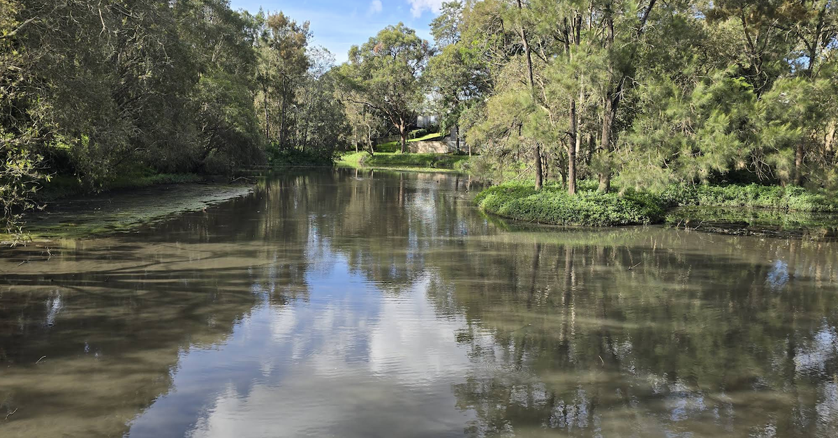
Desilting works at Keith Boden Wetlands in Wavell Heights are continuing as part of a staged program to improve the site’s stormwater treatment function. The project focuses on removing sediment that has accumulated over many years and has affected how effectively the wetland operates.


The current works form one part of a broader approach to maintaining and improving the site. Council’s published timeframe scheduled the project for completion by July 2026, but its webpage still listed the works as in progress as of early August.

The remaining project scope includes sediment disposal, minor edge stabilisation, removal of temporary works and the gradual restoration of water levels.

Sediment Removal Supports the Wetland’s Original Purpose

Keith Boden Wetlands was constructed at Shaw Park in 1998 to filter sediment and pollutants from stormwater before it enters Kedron Brook and, further downstream, Moreton Bay. As the wetland captures material from the surrounding catchment, sediment naturally collects within the system.

Over time, that build-up can reduce the wetland’s ability to function effectively. The current desilting work aims to remove accumulated material and improve the system’s performance.

Funding for the rehabilitation was secured for the 2025–26 financial year. Northgate Ward Cr Adam Allan advised residents in April that works were expected to begin on 25 May, subject to weather and final scheduling.
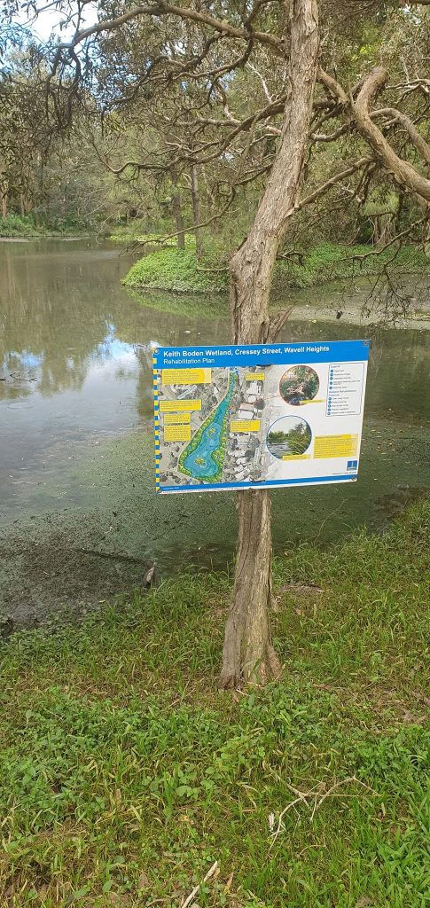
Photo Credit: Clax Saxon/Facebook

Council now describes the current phase specifically as desilting. The sediment removal forms part of a staged approach, while planning for future rehabilitation continues.

Specialised Work Within the Wetland

The project uses specialised equipment within the wetland, while access through the surrounding park is maintained where possible. A temporary track forms part of the works and provides access for construction vehicles and machinery.

The project also includes a contained work area within the wetland to manage water levels safely during sediment removal. Earlier information outlined plans to use a floating excavator within this section.

Workers will dewater the removed material before transporting it to a licensed disposal facility. The scope also includes minor stabilisation along sections of the wetland edge.

After the desilting work, crews will remove temporary infrastructure and allow rainfall to restore normal water levels gradually. These final steps form part of returning the site to its usual operating condition.

Temporary Changes Remain Around Shaw Park

Residents and park users may continue to see machinery around Keith Boden Wetlands while the project remains underway. Pumps may create daytime noise, while disturbed sediment can produce temporary odours.

Water levels may also remain lower during the works and for a short period afterwards. These temporary changes should ease once the project finishes and rainfall gradually restores normal conditions.

Access through Shaw Park will be maintained where possible during construction. Traffic control and detours will help keep pedestrians and cyclists clear of active work areas.


The project’s central purpose remains to improve the wetland’s ability to intercept sediment and other pollutants before stormwater reaches Kedron Brook and Moreton Bay. The current desilting phase addresses the immediate build-up while longer-term rehabilitation planning continues.

Published 4-Aug-2026
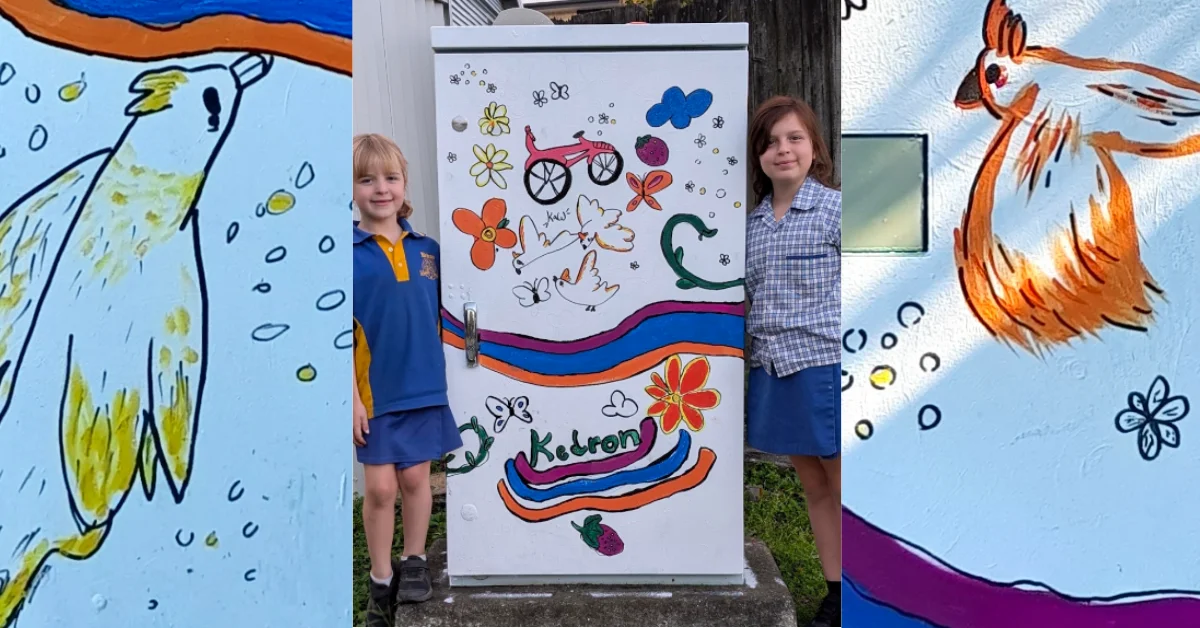
Cockatoos at Dawn: Wavell Heights Intersection Comes Alive

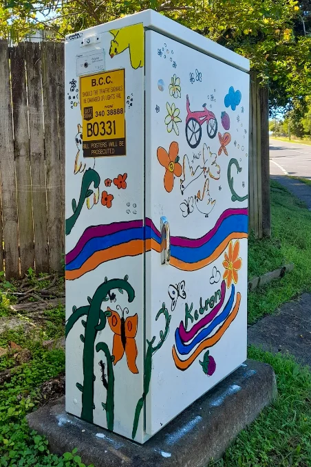
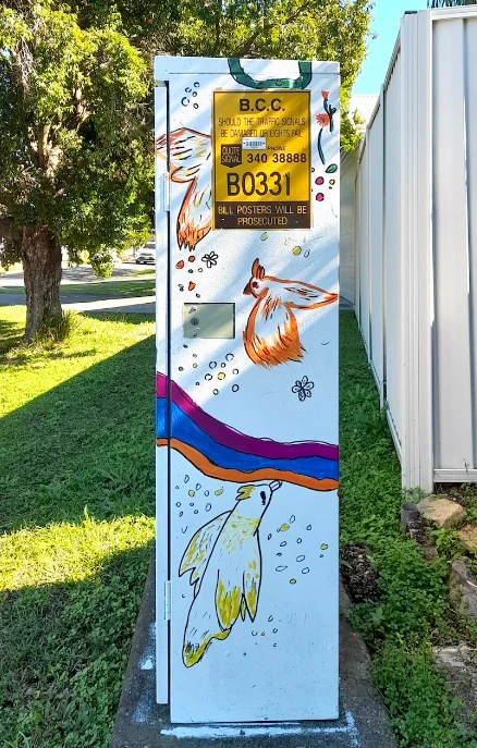
A Wavell Heights artwork titled Morning of the Cockatoos has turned a traffic signal box at the corner of Edinburgh Castle Road and Pfingst Road into a depiction of local wildlife, recreation and history.


Local Experiences Shape the Wavell Heights Artwork

Alana Lucko created and named Morning of the Cockatoos, which was produced in May 2026. Ella Dillon and Violet Lucko were listed as additional participants, while Timothy Lucko supervised the project. Kedron State School was the organisation connected with the work.

Each part of the design represents something linked to Alana’s local experiences. The rainbow represents Kedron Brook and its bikeway, while the cockatoos are birds she sees during her morning swims. Bicycles refer to riding with friends, and strawberries represent picking fruit close to home.

Artforce Brisbane
Photo Credit: Artforce Brisbane

The artwork also includes a farmer’s hat acknowledging the area’s agricultural history. A chicken was included in recognition of the many Kedron residents who keep chickens.

The completed traffic signal box is identified as B0331 and stands at the Wavell Heights intersection.

Part of the Artforce Brisbane Program

The Wavell Heights artwork forms part of Artforce Brisbane, a community art program that allows residents to paint original designs on traffic signal boxes across the city.

The program began in 1999 and has involved more than 5,000 volunteers, who have painted more than 1,200 boxes. Participation is open to Brisbane residents of different ages, abilities and backgrounds.

Wavell Heights artwork
Photo Credit: Artforce Brisbane

Traffic signal boxes contain the electronic controls for traffic lights and are positioned at signalised intersections and crossings. Brisbane City Council owns and manages more than 1,000 of the boxes.

As cabinets are replaced and intersections are upgraded, new painting locations become available. Around 80 Artforce painting opportunities are offered each year across Brisbane, including traffic signal boxes and a small number of Energex padmount transformers.


Artforce Brisbane uses the boxes to display artworks connected with suburban characters, cultures, histories and landmarks. Collectively, the painted sites create an outdoor gallery visible from roads across Brisbane and present different community perspectives in public spaces.

Residents interested in painting a traffic signal box can register through Artforce Brisbane.

Published 22-July-2026

Wavell Heights Road Closure Reinforces Benefits of Automated Flood Alerts

The Automated Flooded Road Warning System (AFRWS) installed on Shaw Road, Wavell Heights, was crucial in preventing motorists from entering dangerous floodwaters following heavy rainfall from Cyclone Alfred. The system, designed to enhance road safety, ensures timely alerts and road closures, reducing risks during extreme weather events.


Wavell Heights flood warnings
Caption: Shaw Road flooded due to ex-Cyclone Alfred.
Photo Credit: CrAdamAllan/Facebook

Enhancing Safety with Real-Time Alerts

BCC has installed AFRWS across flood-prone locations, including Shaw Road. The system was tested following Cyclone Alfred, which caused significant flooding. The LED road signs are triggered automatically when water levels exceed a safe threshold. This effectively alerts motorists to the road closure, preventing potential hazards.

The system operates via solar-powered technology and is designed for high visibility. It ensures that alerts remain functional even during extreme weather conditions when power outages may occur. Some locations are also equipped with cameras for remote monitoring.

How the AFRWS Works

AFRWS is a solar-powered system that helps keep drivers safe from floodwaters. It automatically lights up LED signs when flooding occurs. Messages like “ROAD CLOSED AHEAD” or “ROAD CLOSED—NO ENTRY” appear when activated. The signs stay bright day and night, making sure drivers can see them even in bad weather.

Automated Flooded Road Warning System (AFRWS)
Caption: Shaw Road flooded due to ex-Cyclone Alfred.
Photo Credit: CrAdamAllan/Facebook

Shaw Road Flooding: A Timely Warning

Following heavy rainfall from Cyclone Alfred, Shaw Road became flooded, with warning signs activating as water levels rose. The traffic lights remained functional, assisting motorists as the situation developed rapidly. Other low-lying areas nearby also experienced flooding. This reinforces the need for automated flood warnings in vulnerable locations.

Future Expansion of AFRWS

BCC has committed to expanding AFRWS across additional flood-prone areas. More locations are being assessed as part of a broader strategy to improve road safety. This initiative complements other safety measures, including:

  • Wildlife Awareness Monitors (WAMs) – alerting drivers to potential wildlife hazards
  • Speed Awareness Monitors (SAMs) – helping reduce speeding in suburban areas

Community Response and Next Steps

Residents and drivers in Wavell Heights have embraced the AFRWS. However, even with the system, BCC reminds motorists to check road conditions regularly and always follow warning signs during severe weather.


For more information on the AFRWS initiative, motorists can contact BCC at 07 3403 8888.

Published 11-Mar-2025

Norths Rugby Club Avoids Serious Damage From Cyclone Alfred

Norths Rugby Club has avoided serious damage despite threatening floodwaters in Wavell Heights from ex-tropical cyclone Alfred.


The club, located at Hugh Courtney Oval near Kedron Brook, potentially faced a $50,000-plus recovery bill as water levels rose toward the crossbar of goalposts on Sunday. Director of Rugby Michael Bell witnessed the brook overflowing around 7:30-8:00 AM Sunday, with water advancing across the playing field within an hour.

“If it gets into the clubhouse we are in a lot of trouble,” Bell had said on Sunday, noting approximately $50,000 worth of newly ordered playing gear was at risk, along with irreplaceable club memorabilia.

Kedron Brook
Photo Credit: Facebook / Carolynne Berry

However, a Monday morning assessment revealed a more positive outcome for the Wavell Heights sporting facility.

“Out and about this morning checking on key areas that are often hit the hardest by extreme weather – our local clubs down at Shaw Road have debris on the roads leading in to their carpark and along fence lines but the Norths Rugby Club and cricket fields have avoided serious damage,” MP Leanne Linard reported.

This comes as significant relief for the Wavell Heights club, particularly given their difficult experience during the 2022 floods when water levels at the club reached just below the goalpost pads and came within 6 meters of the club concourse.


While some cleanup will be necessary to clear debris from roads and fence lines in the Shaw Road sporting precinct, the Wavell Heights facility appears to have escaped the worst-case scenario that officials feared when Kedron Brook’s banks first broke.

Published 10-March-2025

The Kedron Brook Lighting Restoration Works Commences

The Kedron Brook restoration works involving lighting restoration on Gympie Road to Shaw Road have commenced.


Read: Dental Practice to Open on Edinburgh Castle Road


Lighting restoration works between Gympie Road, Kedron to Shaw Road, Wavell Heights commenced in early February with completion of works expected by late March 2023.

The restoration works along Kedron Brook Bikeway between Gympie Road, Kedron and Shaw Road in Wavell Heights will include the installation of luminaires and poles, electrical cabling works, and adding topsoil and turf. However, restoration works will vary at each location depending on the level of damage at the light.

The lighting infrastructure along Kedron Brook was significantly impacted by the February 2022 floods. Sections of Kedron Brook were critically damaged by the flood waters. Restoration works across the brook are now underway.

Moreover, electrical infrastructure along the Kedron Bikeway was also significantly damaged following the severe weather event last year. Electrical inspections have already been carried out across the length of the bikeway and the lights have been switched on where it is safe to do so.

Following these inspections, however, a large number of poles, luminaries, electrical pits and cabling were identified to have been severely damaged and must be replaced as part of the restoration process.

Lighting restoration works are now underway along the Kedron Brook Bikeway, with works expected to progress throughout early 2023.


Residents who live or travel through the area may experience low-level noise, truck movements, vibration and dust during restoration works. The bike path will remain open with minimal disruptions expected. Council encourages road users to follow any signage on site.

For inquiries about the project, you may contact the Council’s City Projects Team at 1800 884 681 or email cityprojects@brisbane.qld.gov.au.

Published 5-March-2023.