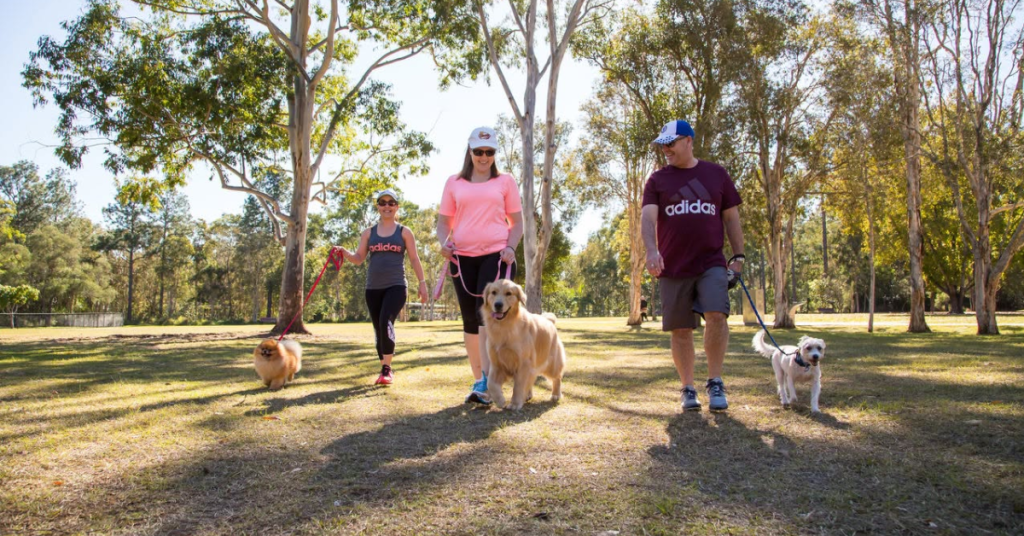
If you have ever wondered where to legally let your dog run free in Northgate, local authorities are reminding residents to stick to designated off-leash zones to keep everyone safe.
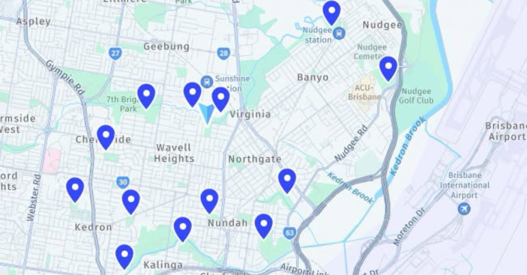
Across the Northgate Ward, nine dedicated off-leash areas offer a mix of fenced perimeters, open layouts, and direct water access. Tuckeroo Park at Nudgee Beach includes a separate enclosure for smaller dogs and a path straight to Kedron Brook, while options like Murray Duus Park and Northgate Reserve provide secure play spaces closer to residential streets.
Unfenced choices such as Downfall Creek and fifth avenue in Kedron give adventurous pets more room to roam, backed by nearby facilities in surrounding suburbs like Chermside and Kalinga.
Why do boundary limits and active supervision matter so much in shared spaces? Handlers must constantly monitor animal behaviour to prevent friction, keeping large dogs out of zones specifically designated for smaller pets. Furthermore, staying proactive with council registrations and vaccinations protects the wider animal population while ensuring smooth community interactions.
Bagging waste and tossing it into the nearest bin takes only a few seconds, yet this simple habit preserves the green appeal of local reserves for everyone. Prompt clean-up routines prevent environmental wear and tear, ensuring that public parks remain inviting destinations for families, wildlife, and pets alike.
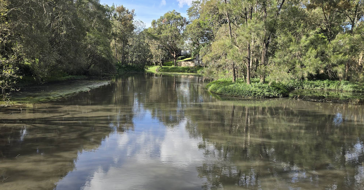
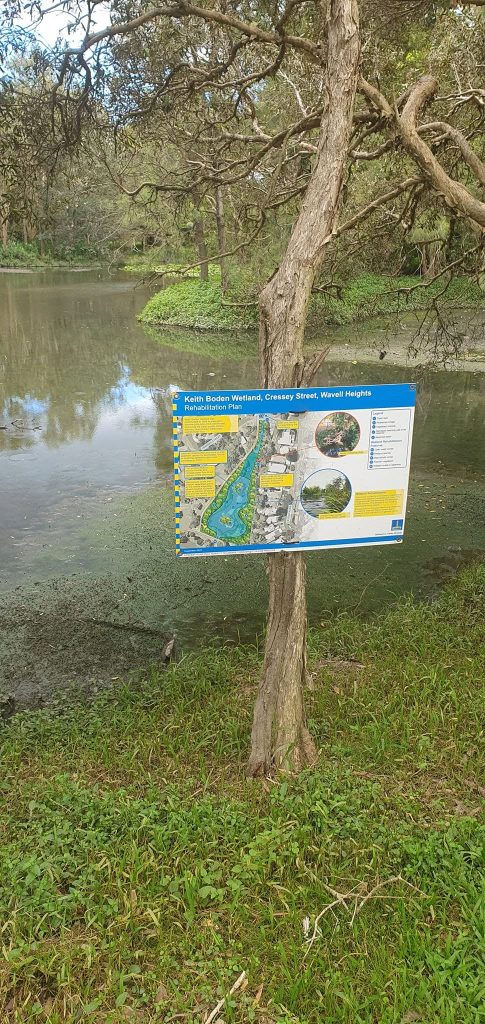
Desilting works at Keith Boden Wetlands in Wavell Heights are continuing as part of a staged program to improve the site’s stormwater treatment function. The project focuses on removing sediment that has accumulated over many years and has affected how effectively the wetland operates.
The current works form one part of a broader approach to maintaining and improving the site. Council’s published timeframe scheduled the project for completion by July 2026, but its webpage still listed the works as in progress as of early August.
The remaining project scope includes sediment disposal, minor edge stabilisation, removal of temporary works and the gradual restoration of water levels.
Sediment Removal Supports the Wetland’s Original Purpose
Keith Boden Wetlands was constructed at Shaw Park in 1998 to filter sediment and pollutants from stormwater before it enters Kedron Brook and, further downstream, Moreton Bay. As the wetland captures material from the surrounding catchment, sediment naturally collects within the system.
Over time, that build-up can reduce the wetland’s ability to function effectively. The current desilting work aims to remove accumulated material and improve the system’s performance.
Funding for the rehabilitation was secured for the 2025–26 financial year. Northgate Ward Cr Adam Allan advised residents in April that works were expected to begin on 25 May, subject to weather and final scheduling.
Council now describes the current phase specifically as desilting. The sediment removal forms part of a staged approach, while planning for future rehabilitation continues.
Specialised Work Within the Wetland
The project uses specialised equipment within the wetland, while access through the surrounding park is maintained where possible. A temporary track forms part of the works and provides access for construction vehicles and machinery.
The project also includes a contained work area within the wetland to manage water levels safely during sediment removal. Earlier information outlined plans to use a floating excavator within this section.
Workers will dewater the removed material before transporting it to a licensed disposal facility. The scope also includes minor stabilisation along sections of the wetland edge.
After the desilting work, crews will remove temporary infrastructure and allow rainfall to restore normal water levels gradually. These final steps form part of returning the site to its usual operating condition.
Temporary Changes Remain Around Shaw Park
Residents and park users may continue to see machinery around Keith Boden Wetlands while the project remains underway. Pumps may create daytime noise, while disturbed sediment can produce temporary odours.
Water levels may also remain lower during the works and for a short period afterwards. These temporary changes should ease once the project finishes and rainfall gradually restores normal conditions.
Access through Shaw Park will be maintained where possible during construction. Traffic control and detours will help keep pedestrians and cyclists clear of active work areas.
The project’s central purpose remains to improve the wetland’s ability to intercept sediment and other pollutants before stormwater reaches Kedron Brook and Moreton Bay. The current desilting phase addresses the immediate build-up while longer-term rehabilitation planning continues.
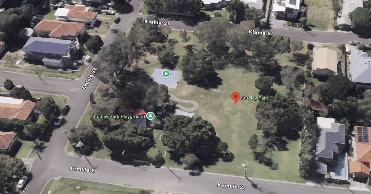
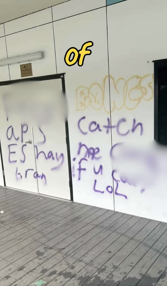
Locals who frequent Studley Park in Wavell Heights will now be under the watch of a temporary CCTV safety camera after reports of illegal drug use, discarded syringes and antisocial behaviour prompted action from local representatives.
The safety measure follows concerns raised by residents living near the park, particularly around the Pfingst Road area, where community members reported incidents that they said were affecting the safety and enjoyment of the local green space.
Reports From Residents Prompt Action
Northgate Ward Cr Adam Allan said his office had received reports of ongoing antisocial behaviour and illegal drug use at Studley Park.
Local MP Mick de Brenni has also recently raised concerns about community safety and vandalism in the wider area, calling for additional safety cameras and police resources.
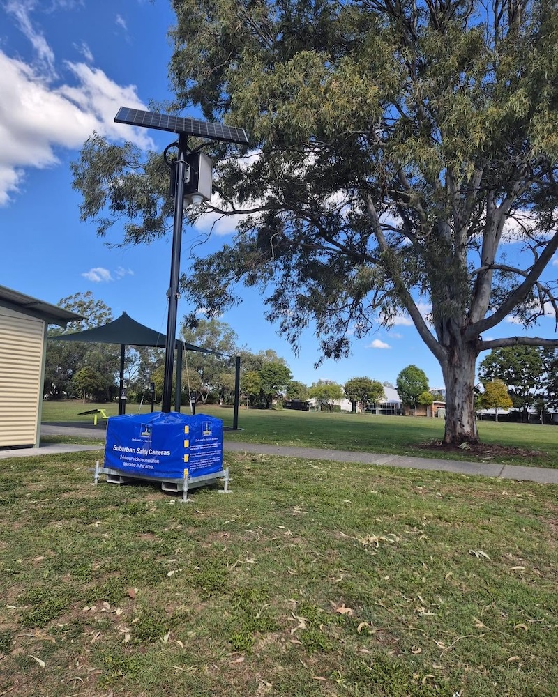
In response, Brisbane City Council arranged for a temporary CCTV safety camera has been installed at the park and would be actively monitored to support community safety and assist investigations by the Queensland Police Service when required.
The installation forms part of a broader response aimed at addressing concerns raised by residents who have continued reporting incidents in and around the park.
Sharps Disposal Bins Added Near Studley Park
Alongside the camera installation, Council is also introducing sharps disposal bins in the area.
The move comes after reports of discarded syringes being found in and around Studley Park. Residents who come across syringes are being encouraged to contact Council so they can be collected and disposed of safely.
Mr Allan said community members had played an important role by reporting issues and helping authorities understand the extent of the problem. He encouraged residents to continue reporting incidents of illegal drug use and antisocial behaviour through Policelink, noting that criminal matters remain the responsibility of the Queensland Police Service.
For many residents who regularly use Studley Park, the new measures are intended to help improve safety and confidence in one of Wavell Heights’ local recreational spaces.
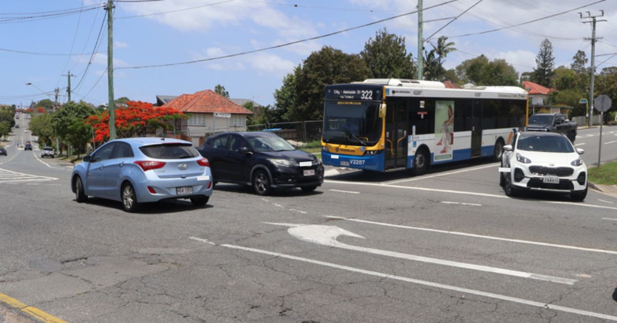
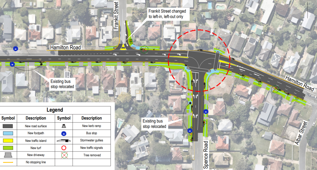
The Hamilton Road and Spence Road intersection carries heavy traffic throughout the day, with long wait times and limited visibility making it difficult for drivers to safely enter and exit Spence Road. The planned upgrade will install traffic signals at the intersection, along with a series of improvements designed to make the crossing safer and more reliable for drivers, pedestrians and bus passengers alike.
The project is currently in progress, with the construction timeline still being finalised pending funding confirmation.
What the Upgrade Involves
The centrepiece of the works is a full set of traffic signals at the intersection, including signalised pedestrian crossings. The right-turn lane on Hamilton Road into Spence Road will be extended, and both corners of Spence Road at Hamilton Road will be widened to formalise two westbound traffic lanes on approach to and through the intersection.
Bus stops will shift as part of the works. The westbound stop on Hamilton Road (stop 43) moves 30 metres west, and the northbound stop on Spence Road (stop 42) moves 30 metres south. Footpaths will be upgraded, new kerb ramps installed, and stormwater infrastructure on both roads within the project area will be renewed. New road pavement, signage, line marking and landscaping complete the scope.
One change will be permanent from the outset: access from Frankit Street onto Hamilton Road will become left-in, left-out only. A new pedestrian refuge on Frankit Street at Hamilton Road will also be installed. Residents who currently turn right out of Frankit Street will need to adjust their routes once construction begins, and the project team is available to discuss alternative travel options.
A Corridor with a History of Safety Concerns
Hamilton Road has been a focus of road safety investment for several years. The intersection with Bilsen Road was upgraded under the Black Spot Program after recording nine crashes between 2015 and 2021, all of which required medical treatment or hospitalisation. That project delivered dedicated right-turn pockets, updated signal phasing and relocated bus stops, and is now complete.
The Spence Road intersection presents a similar set of challenges. High traffic volumes, extended wait times and limited sightlines have made it difficult for drivers to safely navigate the crossing, mirroring the conditions that prompted action at Bilsen Road.
A Safer Street for the People Who Use It Every Day
For residents living near the intersection, this upgrade addresses a problem that has been part of their daily routine for years. Hamilton Road serves as one of the key east-west connectors through Wavell Heights’ inner north, and the Spence Road junction has long added unnecessary time and uncertainty to morning and afternoon trips.
The inclusion of signalised pedestrian crossings is a meaningful addition for those who travel the area on foot, where crossing Hamilton Road currently requires careful judgement and a degree of patience.
Broader traffic studies have pointed to ongoing pressure across Wavell Heights roads, with congestion on surrounding arterials including Sandgate Road and Gympie Road continuing to push traffic onto local streets. Intersection-level upgrades like this one address safety at specific points, and combined with previous works along the corridor, represent a sustained effort to improve conditions for the community.
How to Stay Across the Project
The construction program is still being finalised, and more detail on timing will be shared once that process is complete. Residents can register for project update emails through this link.
For questions, including advice on alternative routes around the Frankit Street access change, contact the project team on 07 3178 5413 (Monday to Friday, 8.30am to 4.30pm), or email cityprojects@brisbane.qld.gov.au with the subject line “Hamilton Road and Spence Road intersection upgrade.” Written enquiries can be directed to Infrastructure Services, GPO Box 1434, Brisbane QLD 4001. General enquiries can be made to 07 3403 8888, available 24 hours a day, seven days a week.